Airport Connectivity from North Bangalore
North Bangalore reaches Kempegowda International Airport on one road. NH-44 (Bellary Road) is the spine. Everything north of Hebbal feeds into it. The closer you are to Devanahalli, the shorter the run.
Distance sets the picture. The airport is about 28 km from the Hebbal flyover. It is about 38 km from MG Road. From the Devanahalli belt it is about 5 km, roughly 10 minutes.
That gap is the whole story of the corridor. Airport access here is not a marginal advantage. It is structural. This guide sets out why, and what Terminal 2 changes.
NH-44 as the Spine
What the road is
NH-44 is India's longest national highway. It was numbered NH-7 before renumbering. The Bengaluru stretch is a wide, access-controlled trunk road. It carries airport traffic, freight and intercity buses together.
The airport approach
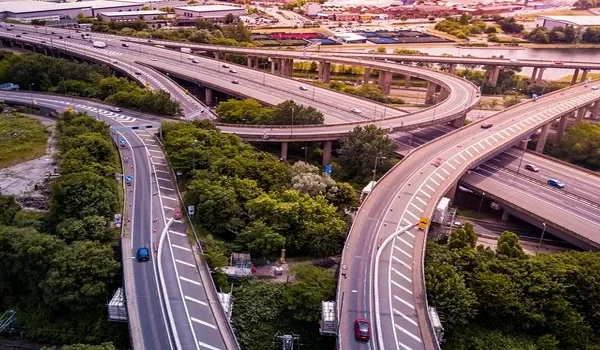
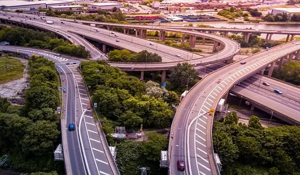
Trumpet interchanges lift airport traffic clear of the through carriageway. That keeps the terminal approach separate from highway flow. It is the reason the last few kilometres stay quick. Congestion builds further south, not here.
The practical lesson is simple. The road works well at the northern end. It struggles closer to the city. Position on the corridor decides your experience.
Distances Along the Corridor
Airport access from north Bangalore is best read as distance along NH-44. Drive times swing with traffic, so distance is the steadier measure.
| Point on the corridor | Distance to the airport | Character of the run |
| Devanahalli belt | About 5 km | About 10 minutes, largely free-flowing |
| Doddaballapur Road junction | Feeds in at about 8 km from the belt | Links the western industrial cluster |
| Hebbal flyover | About 28 km from the belt | The main city bottleneck on the axis |
| MG Road | About 38 km from the belt | The full city leg |
The pattern is clear. The northern end is short and clean. The southern end is long and traffic-bound. Airport proximity is earned by being north of Hebbal.
Terminal 2 and What Capacity Growth Means
The numbers
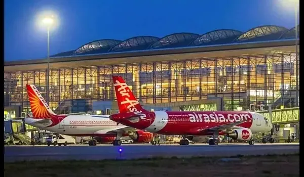
Kempegowda International Airport is India's third-busiest. Terminal 2 is built and ramping up. It adds capacity for 25 million passengers a year. That lifts the airport past 37 million, on top of the existing 12 million.
What that does on the ground
More passengers mean more flights, more staff and more freight. Airline crews, ground handlers and cargo operators all need to live near. Hotels and offices follow the traffic. Housing demand follows the jobs.
This is why airport capacity matters to residential buyers. It is not about flying often. It is about employment density arriving nearby.
| Measure | Figure |
| Existing terminal capacity | About 12 million passengers a year |
| Terminal 2 addition | About 25 million passengers a year |
| Combined capacity | Past 37 million passengers a year |
| National ranking | India's third-busiest airport |
Capacity is not the same as traffic. A terminal ramps up over years, not months. But the ceiling is now much higher. Growth on this corridor has room to run.
Why Airport Proximity Is Different
It is not a peak-hour commute
Office commutes cluster at two times a day. Airport trips do not. Flights run from before dawn until late night. The road load spreads across the clock instead of spiking.
It does not decay as the area fills
A tech-park advantage weakens as more people move near it. Roads clog and the edge erodes. An airport cannot be duplicated. Distance to it is fixed, whatever gets built around.
It serves a different user
Frequent flyers, aviation staff, cargo firms and hotels all value the same thing. That mix is wider than a single employer's payroll. It makes demand less brittle. One company leaving does not empty the belt.
The freight side is invisible but real
Cargo terminals run around the clock. They pull warehousing, customs agents and logistics firms nearby. None of that shows in a residential brochure. All of it supports the local economy.
The Rail Layer That Will Follow
Road is the only fast link today. The Namma Metro Blue Line is being built to add rail. It runs Central Silk Board to KR Puram to the airport. Total length is about 58.19 km.
| Layer | Status | What it serves |
| NH-44 road | Operating | All airport traffic today |
| BMTC airport buses | Operating | Corridor stops between the city and the terminals |
| Namma Metro Blue Line | Under construction | City to airport rail, once open |
No Blue Line station is open. Dates on this corridor have moved before. Read rail as a future layer over a road corridor that already works.
Who Gains from Being Close
The clearest gainers are people who fly often and people who work in aviation. For them, 5 km against 38 km is hours saved every month. That difference compounds.
The second group is quieter. Employers in the KIADB aerospace and business-park belt draw staff who want short journeys. Homes near the airport serve that demand. Residential projects along the belt, including Milan at Godrej MSR City, are placed for it.
Judge any airport claim by distance and by road, not by brochure lines. Ask how the last few kilometres actually run. That is where the advantage lives.
Distances and passenger figures are drawn from published sources and change over time. Verify current airport capacity and metro status with the operators directly. Project approvals should be checked at rera.karnataka.gov.in.
Frequently Asked Questions
1. How far is Kempegowda International Airport from north Bangalore?
It depends on where you start. From the Devanahalli belt it is about 5 km, roughly 10 minutes on NH-44. Hebbal flyover is about 28 km from that belt and MG Road about 38 km.
2. Which road connects north Bangalore to the airport?
NH-44, also called Bellary Road. It is India's longest national highway and was numbered NH-7 earlier. Trumpet interchanges lift airport traffic clear of the through carriageway near the terminals.
3. What does Terminal 2 add?
Capacity for 25 million passengers a year, on top of the existing 12 million. That takes the airport past 37 million in total. Kempegowda International Airport is India's third-busiest.
4. Is there metro access to the airport?
Not yet. The Namma Metro Blue Line is under construction from Central Silk Board through KR Puram to the airport, about 58.19 km in all. No station on the corridor is open.
5. Why is airport proximity treated differently from office proximity?
Airport traffic spreads across the day rather than spiking at peak hours. An airport also cannot be relocated or duplicated, so the distance advantage does not erode as the surrounding area builds out.
6. Do buses serve the airport from north Bangalore?
Yes. BMTC runs airport services along the Bellary Road corridor, and KSRTC uses the same highway for intercity routes. Both are useful, though they share road conditions with everyone else.
Explore Milan at Godrej MSR City